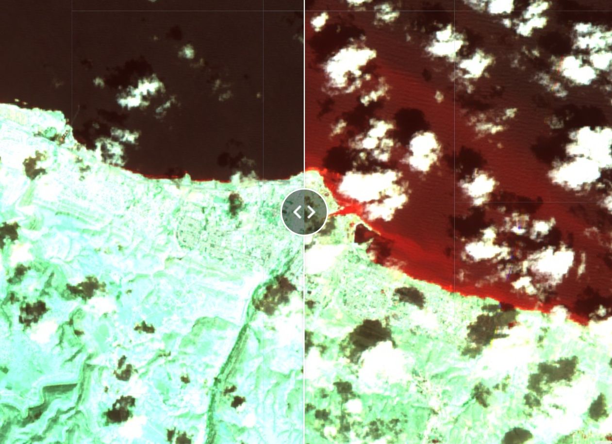
Visualization of Derna Flood using Google Earth Engine
A deadly flooding and devastation occurred in Derna, Libya in 2023 September 10th and 11th followed by the Storm Daniel. The GEE code snippet allows the user to visualize the flooding in Derna

A Geomatics Engineer who loves to make maps that can help protect the Earth from climate change.
A deadly flooding and devastation occurred in Derna, Libya in 2023 September 10th and 11th followed by the Storm Daniel. The GEE code snippet allows the user to visualize the flooding in Derna

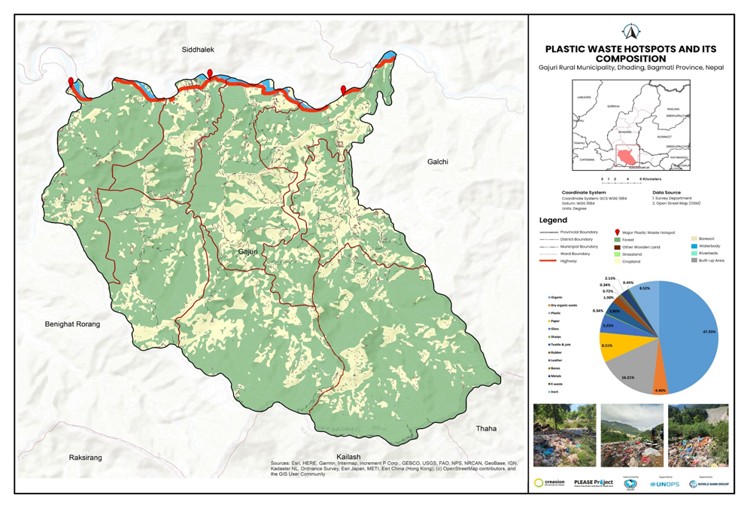
The presentation compares multiple open and commercial flood mapping services.
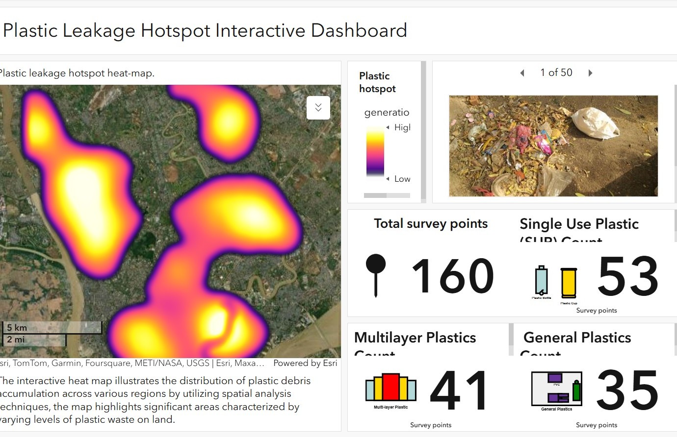
The interactive heat map illustrates the distribution of plastic debris accumulation across various regions by utilizing spatial analysis techniques, the map highlights significant areas characterized by varying levels of plastic waste on land.
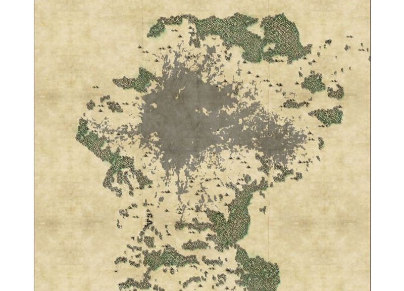
The map is a landcover map of Kathmandu valley of 2010 prepared by extracting data from ICIMOD's spatial data portal. The abstract map uses unique cartography which shows the classes through symbols where indexes are not provided for the viewer to easily interpret the physical features the symbol is representing.
The dashboard provides the scenario of the plastic waste, its waste composition as one of the major deliverables of the project CAP